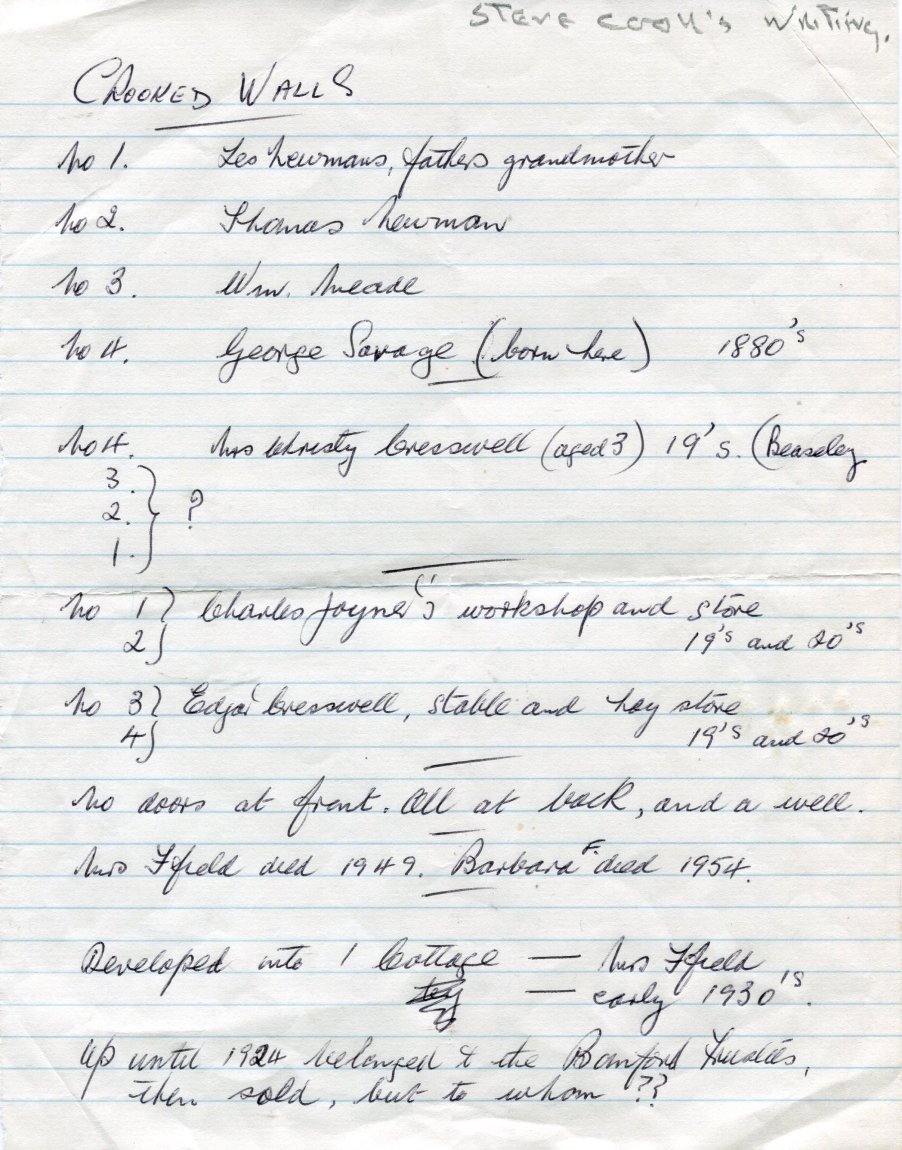
THE CLARKE FAMILY
The Clarke family, Yeomen and churchwardens lived in Crooked Walls in the late seventeenth century, either in the whole or part.
HEARTH TAX FOR 1671 AND 1681, DUTCH WAR TAX 1667, DEATH OF MARY CLARKE 1667:
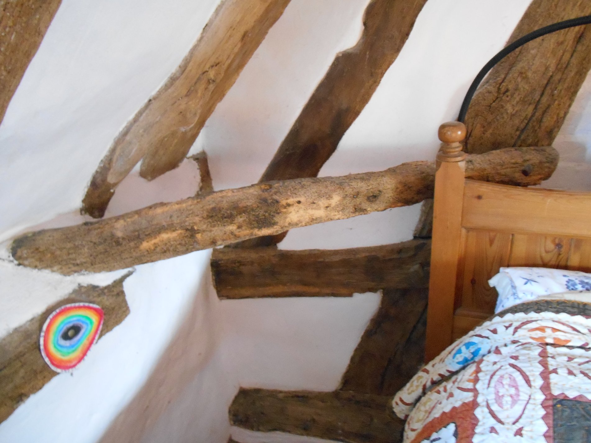
In the 1980's while Ken Davies was renovating the back bedroom in number one, he discovered a number of pieces of paper dating from the seventeenth century. They were lodged in a crevice near the crook in the end wall. Two were receipts for the Hearth Tax of 1671 & 1681. The Hearth Tax records of most counties still survive but they do not normally name ordinary individual houses. It is very rare to find a survival of a receipt from an individual house and thereby fixing a family to a property, in this case 'Clarke'. They also give the tax collector's name and their survival is of great historical value.
The finding of the papers at the far end of the house suggests that at this time the property were divided into either one or two properties but not four as the papers were lodged in the end of the house in what was to become number one while the hearth is situated in the centre of the house between what was to become numbers two and three. There is also an argument for thinking that it was originally just one property with an entrance on the south side directly opposite the chimney stack, a traditional design in the neighbourhood.
Hearth Tax and one raising of money for the 2nd war with the Dutch 1665-67.
There is also a slip of paper giving the date of death and age of Ann Clarke, presumed wife or relative of either Joseph or John Clarke mentioned as paying the Hearth Tax. The Bishops Transcripts appear to record that she was a widow, in which case she is not the wife of the John Clarke who signed the Hearth Tax in 1681.
Documents relating to the raising of taxes often survive and are usually to be found in the National Archives at Kew. They do not however indicate the particular property. The survival of receipts giving the name of the individual and the tax collector, along with an indication of the property is rare indeed. The Hearth Tax was aimed at occupants of houses which possessed hearths; the more hearths one had there the more one paid.
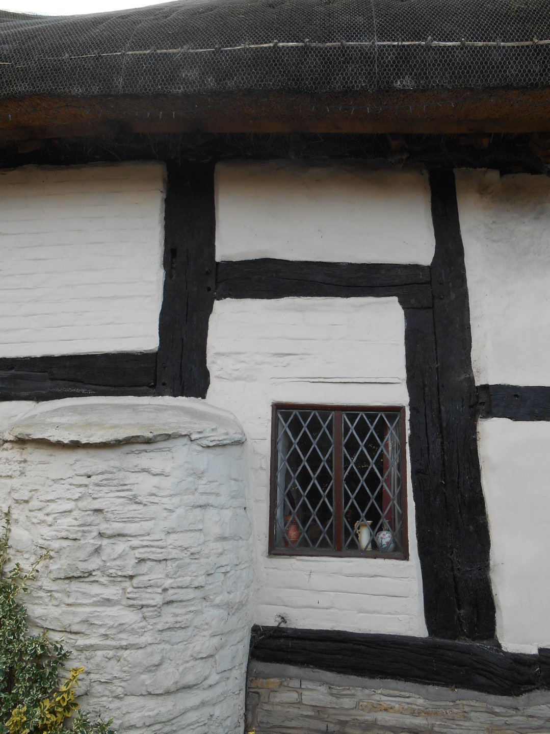
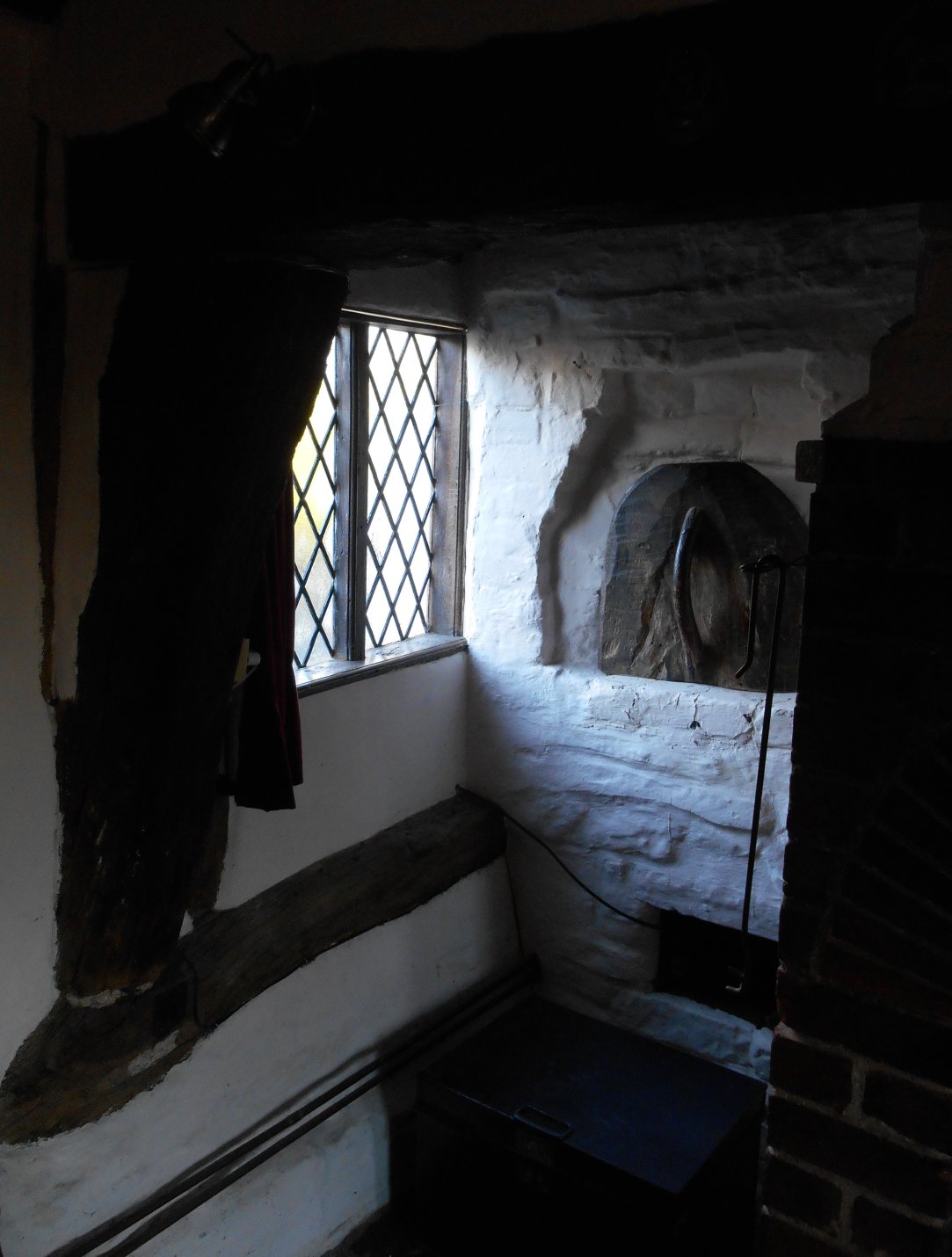
In the central part of the house is a large chimney stack which is shared by two inglenooks. The inglenook for dwelling 2 has an inset salt box, plus a cupboard set up high. The inglenook for dwelling 3 has an inset salt box with a door, plus an attached bread oven. It is possible that at this time there were only two dwellings; one including dwellings 1 & 2; one including dwellings 3 & 4, since both end chimneys were added later. Both parts may have paid the Hearth Tax.
Item 1: Death of Anne Clarke
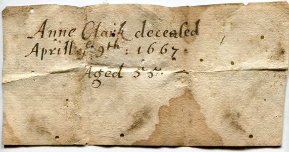
z
Anne Clark deceased
Aprill ye 9th: 1667
Aged 55
Item 2: national raising of money for the war with the Dutch.
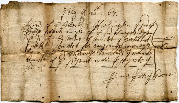
July ye 20th: 67.
Rec d of ye Collectr of Harvington ye sm of
Sixe pounds in yte[?] of ye sd charges uppon
ye Parish By virtue of an act of Parliamt
Intituled an Act for rayseing moneyes
By  or poll if otherwise towards ye maynte
nance of ye prsent warr -- --- reeds[?] ye
sm of
Recd Harry Greene
Item 3: Hearth Tax
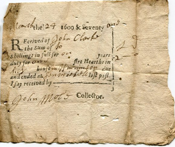
March the 24 1600 & Seventy one
Received of John Clarke
The sum of 10
Shillings in full for one years
duty for one fire Hearths in
his house in Harvington due                 L   J
and ended at Sen Michell last past          2   0
I say received by
John Mole Collector.
Item 4: Hearth Tax.
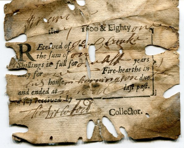
------ are
The 7* 1600 & Eighty one
REceived of Jos[eph] Clarke
The sum of on[e]
Shillings in full for one half years
duty for one Fire hearths in
His House in Harvington due
And ended at March last past
Tho Litwood[?] Collector.

 *     November
An extract from the Record Office in Worcester and was found by Stephen Price, during his researches into the Hearth Tax records for Worcestershire. It records "the Clarke family tenement in Harvington for 1668 - John Clarke and his 20 year old daughter Anne are holding for their lives one messuage and half a virgate of land with appurtenances in Harvington now in the tenure of John Clarke paying rent to the Dean & Chapter of Worcester Cathedral of 4 shillings and 4 pence".
At this time the property was owned by the Diocese of Worcestershire.
During Stephen Price's researches there came to light "a Parliamentary Survey of Harvington for 1649, which records 'John Clarke' as tenant. He is described as a yeoman in some of the court books and served as churchwarden and overseer of the highways at various points in the 17th century".
It appears that John Clarke married in or before 1648, a Yeoman from at least 1649 and made a payment towards the Dutch War on 20th July 1667. He is recorded, along with his daughter Anne, as holding tenure in 1668; he paid the Hearth Tax in 1671 & 1681. He made a payment to the Dutch War in 1667 & paid Hearth Tax in 1671 & 1681. His wife was Anne, was buried in Harvington Churchyard 13th April 1666 or 7, aged 55. John Clarke was buried in Harvington churchyard on 29th of October 1684. They had issue:-
- Anne, held tenure with her father of Crooked Walls in 1668.
- Margaret, baptized Harvington 12th May 1654.
Henry Clarke, Churchwarden 1706-7, presumably the son of John Clarke, married Elizabeth and had the following:-
- Henry, bapt Harvington 19 Mar 1694, buried 3rd October 1695.
- Anne, bapt Harvington 15 Sep 1696.
- Edward, bapt Harvington 28 Oct 1699.
- Mary, bapt Harvington 20 Sep 1701.
- Elizabeth, bapt Havington 22 April 1702.
- Moses, bapt Harvington 5 Sep 1707.
- Martha, bapt Harvington 20 Oct 1709.
- John, bapt Harvington 4 Jun 1713.
Thomas Clarke was churchwarden in 1670. Is Thomas meant to read John?
It is only assumed that Henry Clarke also lived at Crooked walls. A Sarah Clarke was buried 9th May 1732. Also Mary wife of Edward Clarke was buried 23 Mar 1685.
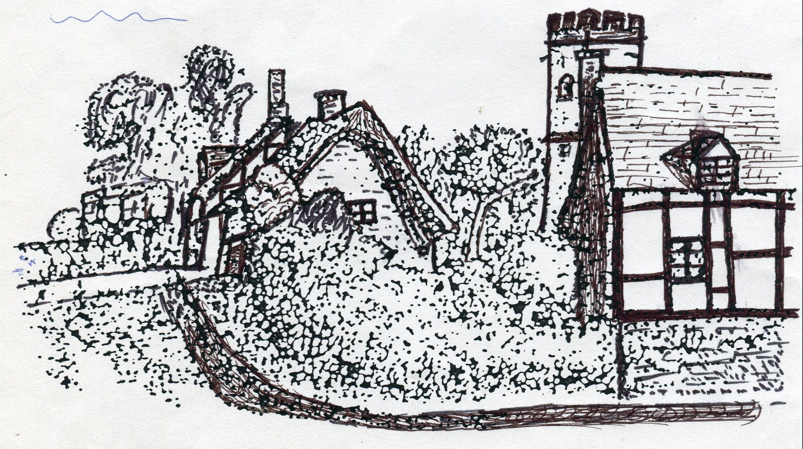
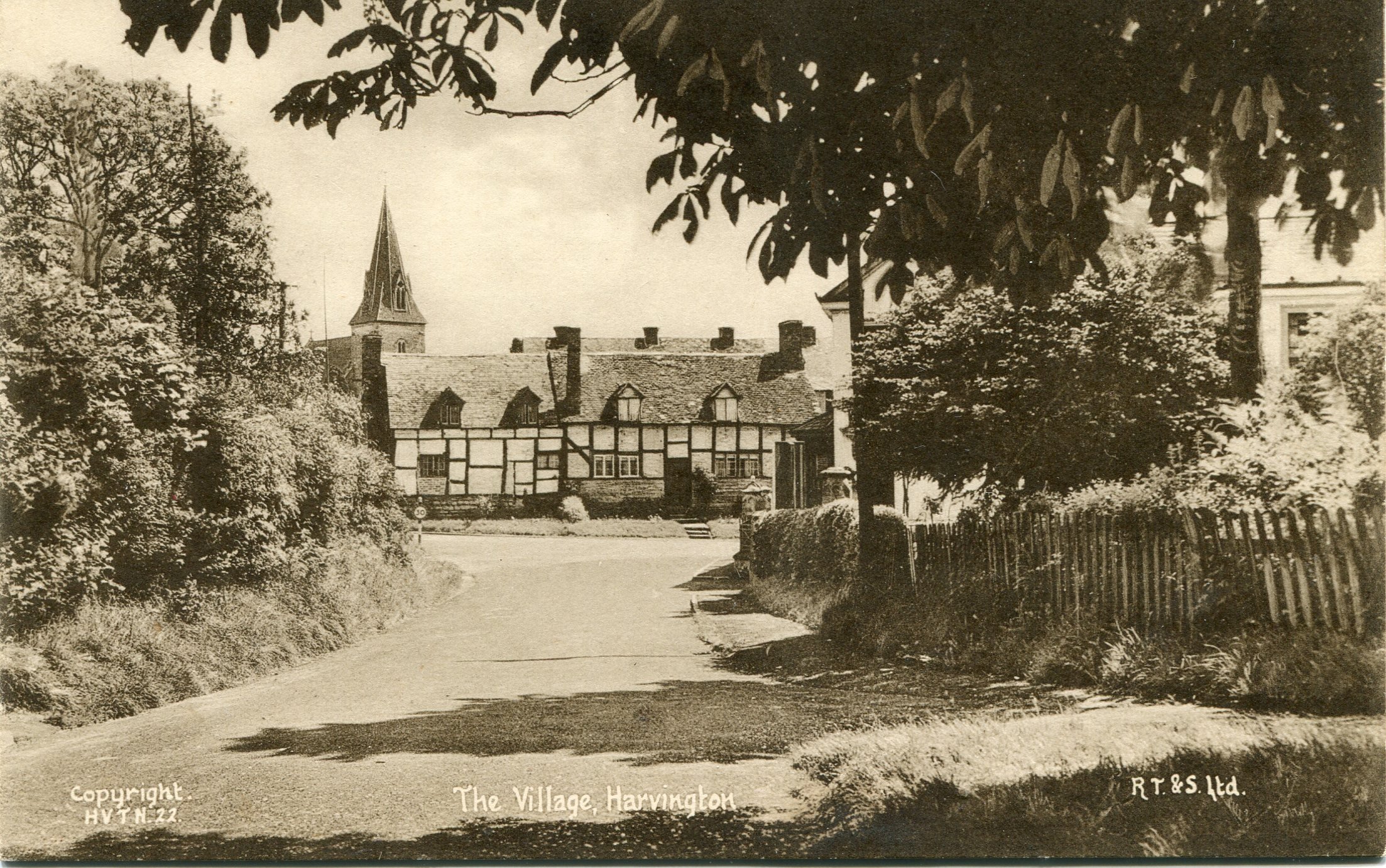
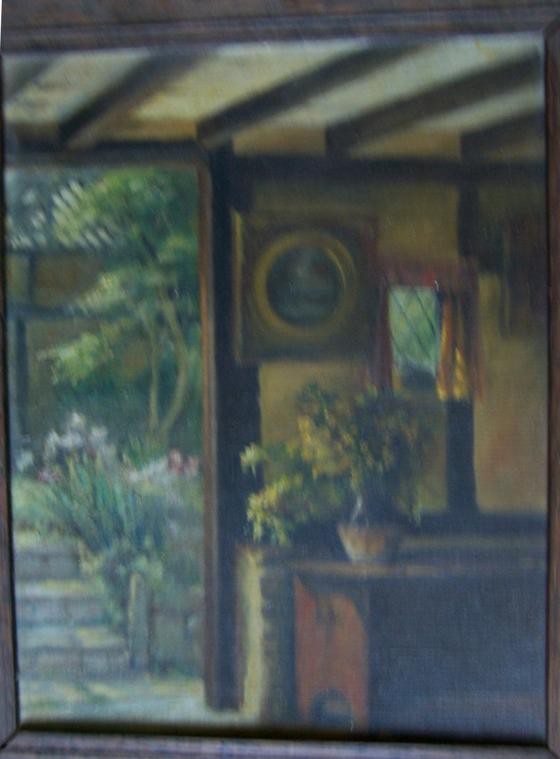
THE FOUR TENEMENTS:
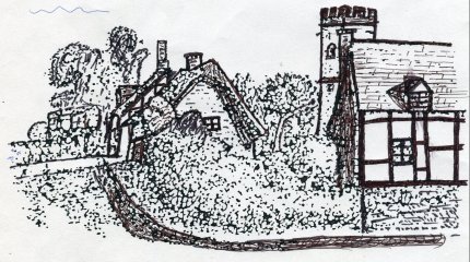
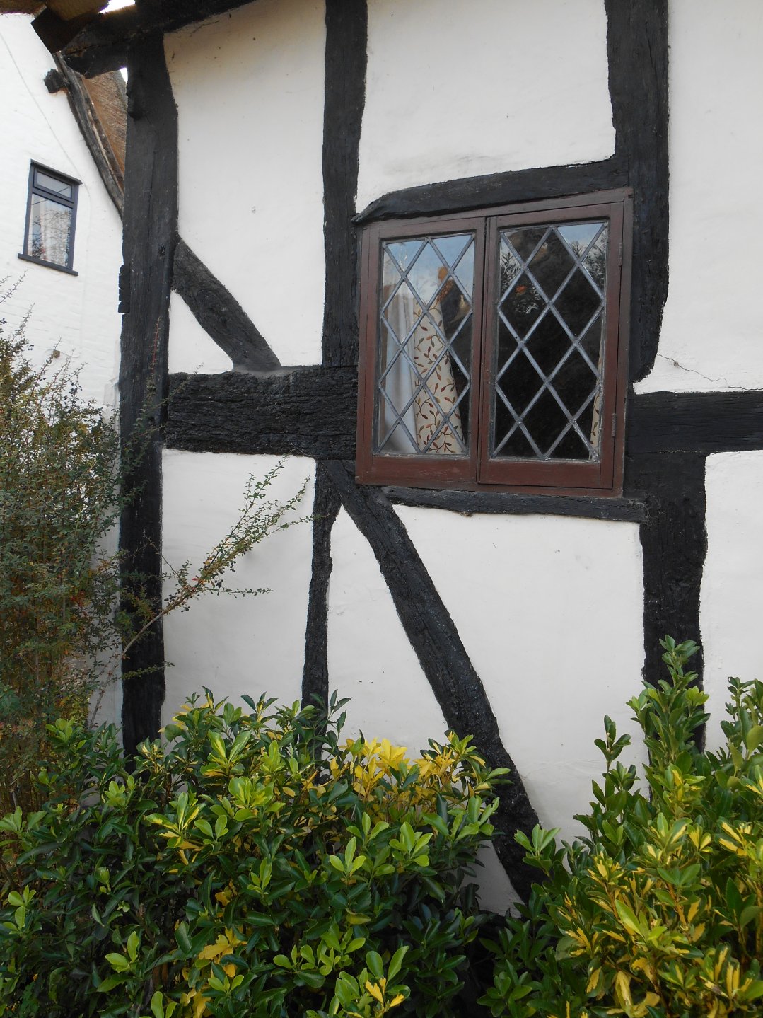
The above pencil drawing was taken from an unknown publication by the late Steve Cook who gave a copy of it to Joy Davies. This little drawing, the earliest image of the property and its surroundings so far found, reveals a number of interesting points. It must date to before 1855 as it is in this year that the church tower in the background acquired its steeple. Before dealing with Crooked Walls, let us observe the surroundings. The building in the foreground, demolished by the Council in the 1930's, has a tiled roof as it did in future photographs. The two houses now known as James and Apple Tree cottages now have rendering on the front, again, as they did in old photographs. In the picture however one can clearly see that James Cottage was timber framed although now its west end is brick. One can also also see its present dormer window and a very tall chimney.
Two major facts can be gleamed for Crooked Walls. It is assumed that it originally had a timber-framed gable. In the sketch this has been replaced by the present brick construction with its centrally positioned window. There is only one central chimney block with no sign of chimneys on the gable ends.
At some stage, probably a long time prior to 1855, the property went through a major change with the addition of chimney stacks at either end. It is suggested that it was at this stage that it was divided into four tenements, which included individual doorways, separate gardens plus two brick-built toilet blocks strategically placed to cater for the four dwellings. During recent construction work, the foundations of a boundary wall were discovered between the gardens of numbers one and two, which joined up with the division between one of the toilet blocks. The hop kiln and its adjacent building is on the 1837 tithe or estate map, so this change may well have taken place prior to 1837.
THE MALIN FARM ESTATE
The following has been gleamed from the deeds of Dalkeith/Malins Farm, of which Crooked Walls was part.
George Malin had been the main beneficiary of William Hawkes Marshall who died on 23rd June 1853 aged 62 and it seems very likely that George Malin moved in to Dalkeith, certainly he was there with his family in 1861 styled as a farmer of 220 acres. William Hawkes Marshall was a major landowner in Harvington. He was a bachelor and in 1851 was living on his own in Village Street, the most likely place being Dalkeith. William Hawkes Marshall or sometimes William Marshall Hawkes had inherited his Harvington property from Thomas Walford Marshall upon that gentleman's decease in 1826. The Marshalls were one of the leading families in Harvington and lived both up at Harvington Lodge and elsewhere in the village.
Once the deeds of Dalkeith became available and in particular the plan dated 16th January 1898, it was clear that Malins Farm was the centre of an estate, which included Crooked Walls.

Plan dated 1898.
The above plan and following schedule is vital in indicating the position of the dwelling houses and land over which Malins Farm (Dalkeith) had control:-
- 18 - Dwellinghouse builings yard and garden occupied by Revd Richards. [Malins Farm]
- 23a - The Close (adjoining) - pasture. [Now St James' Close and land bordering Station Road]
- 50 - Lower Avon Meadow - pasture.
- 33 - The Nurders - arable.
- 34 - Lower Moors - pasture & withies.
- 35 - The Mear - pasture.
- 36 - Withy Bed in Nestor - withies.
- 37 - The Nestor - arable.
- 38 - (part) The Moors - pasture.
- 15 - Orchard called "Parrys Orchard" with cart sheds and other buildings thereon. [It is not clear where this is.]
- 16 - All those 4 cottages with the outbuildings and gardens thereto belonging situate in Harvington aforesaid in the occupation of Newman, Sorrell and others. [Crooked Walls]
- 29a - Part of road to Lower Fields.
- 39a - Part of road to Lower Fields.
- 42 - Orchard Closes - arable.
- 43 - Lower Field - Arable.
- 48 - First Meadow - pasture.
- 21 & 22 - All those 5 cottages and gardens also a small piece of garden ground lying at the back of the said cottages as now hurdled off situate in the village of Harvington now in the occupation of [blank - this is almost certainly Dream Cottage and Ye Olde Cottage.]
THE BOMFORD ESTATE
In 1893 the Malin family sold Malins Farm/Dalkeith and its lands to Ernest George Cooke Bomford of Springhill in Fladbury. The estate was merged into his other holdings and in the 1920s a reduced Malins Farm/Dalkeith estate was sold as Lot 3.
Ernest George Cooke Bomford of Springhill, Fladbury, the son of Benjamin and Mary Bomford, was born at Pitchill in 1849. The Bomford family became major property owners in Harvington with different members settled into a number of Harvington properties becoming in effect Lords of the Manor based at Harvington Lodge. Ernest was a great innovator and grew up to 100 acres of hops in the Chadbury and Fladbury area; started a brewery down at Harvington Mill and had acquired many tied houses in the village.
Ernest Bomford had become a major landowner in Harvington, owning Harvington Mill. Ernest Bomford died at Springhill on 8th March 1901 and his children inherited his estate. In the 1920s Ernest's Harvington estate was broken up and auctioned off in lots.
Lot 2, included not only the four tenements what was to become Crooked Walls, but also a large tract of land stretching down to Shakespeare Lane. However in 15th January 1925 Mrs Edith Davies only purchased the four tenements and a small piece of land to the rear. In or shortly after 1925 the Council purchased the remaining land on which it later built eight council houses.
For a full history of this large family please see the Bomford Family Website, and on this site under Families.
At present it is not possible to identify all the individual lots and the full extent of Ernest Bomford's estate is yet to be realised. So far we have Lot 2 (Crooked Walls), Lot 3 (Malins Farm), Lot 5 (Harvington Mill) can be identified.