| |
 Coach & Horses |
|||
|
There is no order to the following assortment of stories, snippets or memorabilia that has been gathered together and published here, the only connecting factor is the Village. This is a new page so at present there is very little, however it is hoped that in time it it will grow.
Please feel free to use this facility by sending an email with your note or query to the Editor.
APRIL 2026 TWO COUSINS OF PRIME MINISTERS:- Did you know that there are two individuals who were cousins of past prime ministers buried in Harvington?
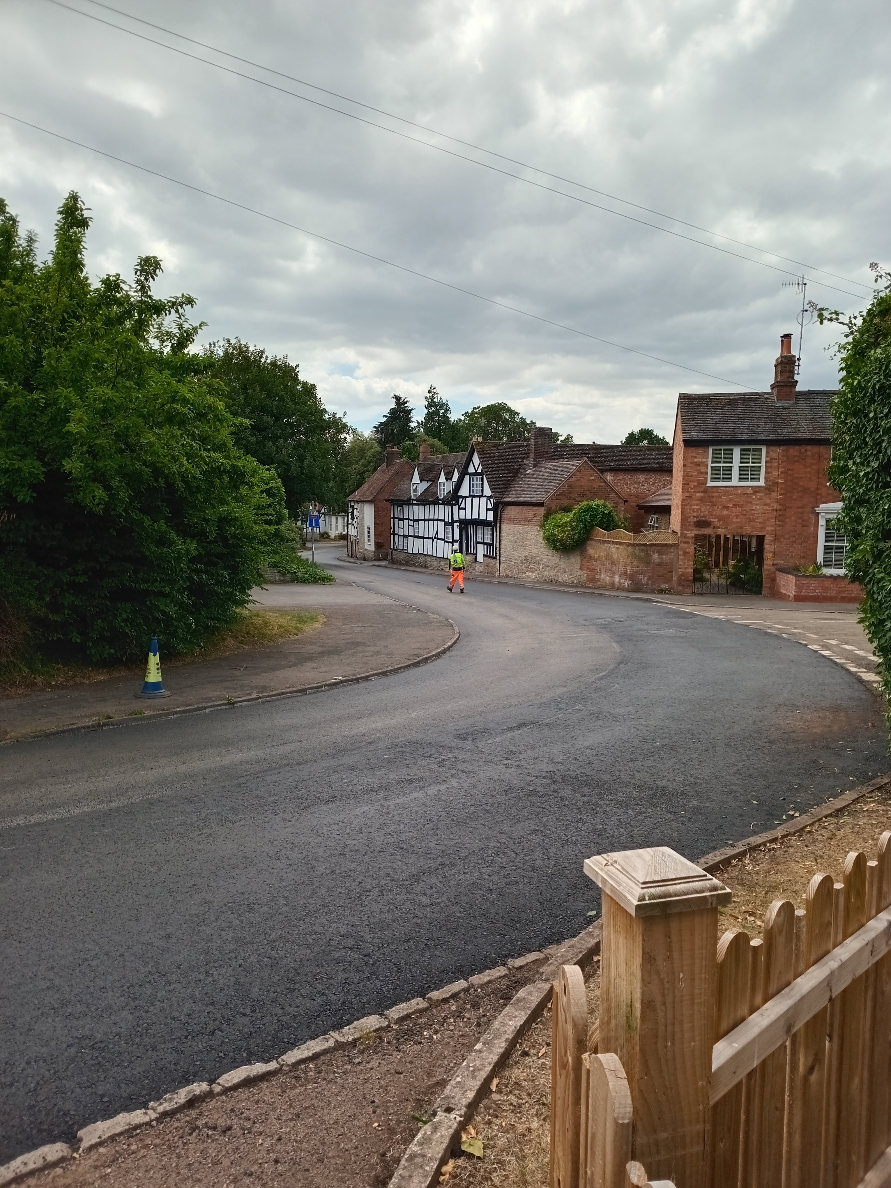
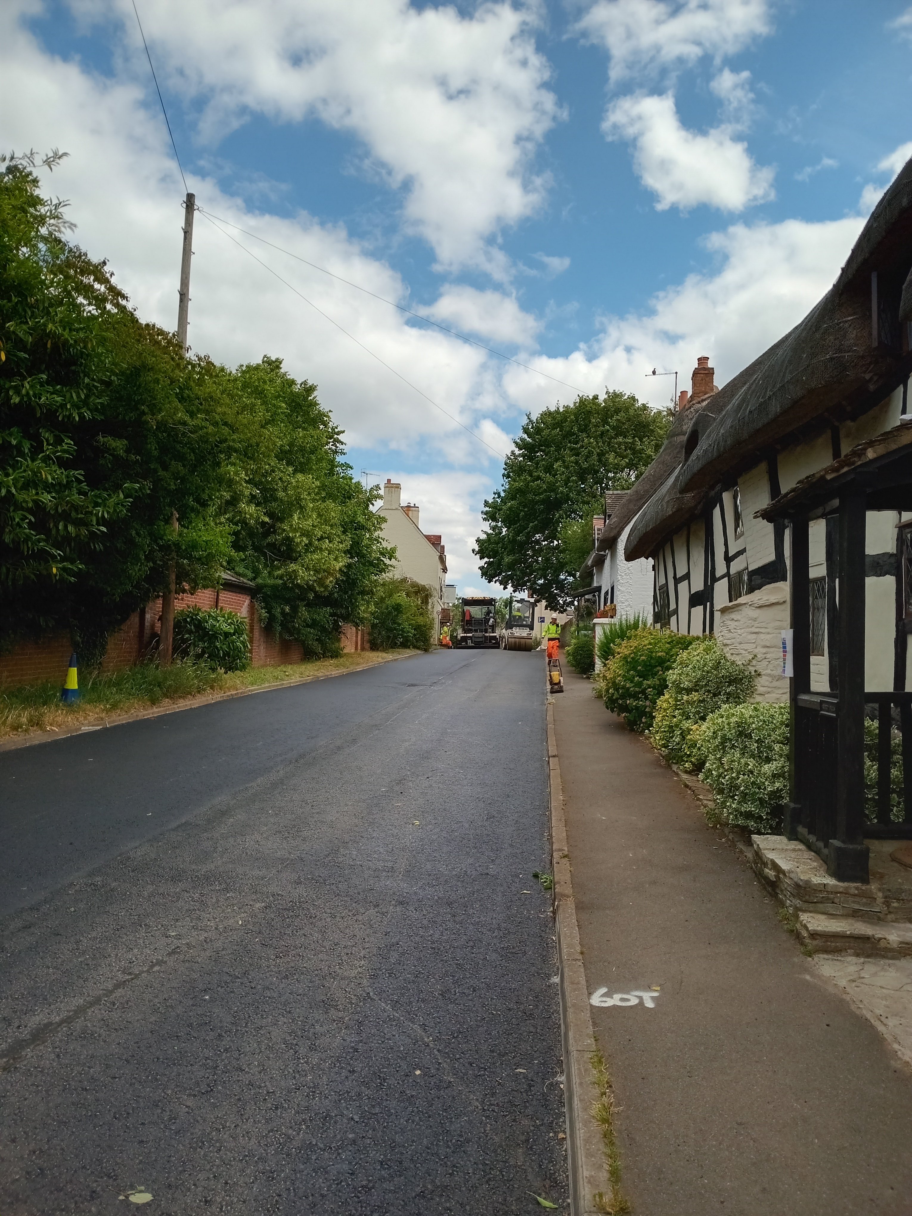
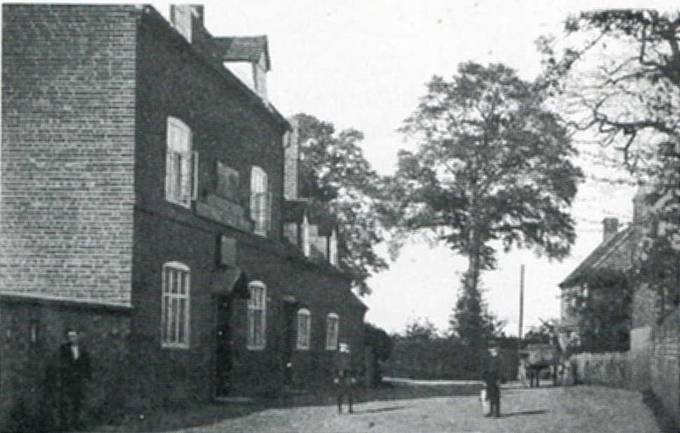
HERBERT GLADSTONE, cousin to William Ewert Gladstone 1808-1898, died in the Evesham Union workhouse in 1891. He is buried in an unknown grave in the churchyard. He was an American Civil War veteran. ROBERT EVELYN EDEN M.C., cousin to Anthony Eden 1897-1977, died in Langton House in Village Street in 1919 and is buried in the Burial Ground. His details are to be found under the section on the Burial Ground. JUNE 2025 THE RESURFACING OF TWO STREETS IN HARVINGTON:- On 25/26th June 2025 both Stratford Road and Church Street were scraped and resurfaced. For many years the road surfaces of both these thoroughfares had been in a poor state of condition owing to time and various utility companies who had cut into the surface. With the building of the old bypass in 1976 the road and street ceased to be a main road, which allowed local children to play in the street and remove the cats eye to be used as marbles! At Crooked Walls we were fascinated by the spectacle of the hard-working surfacing team as they did their job with their huge machines. The resurfacing made us think when it had been surfaced prior to 2025, how old was the surface? 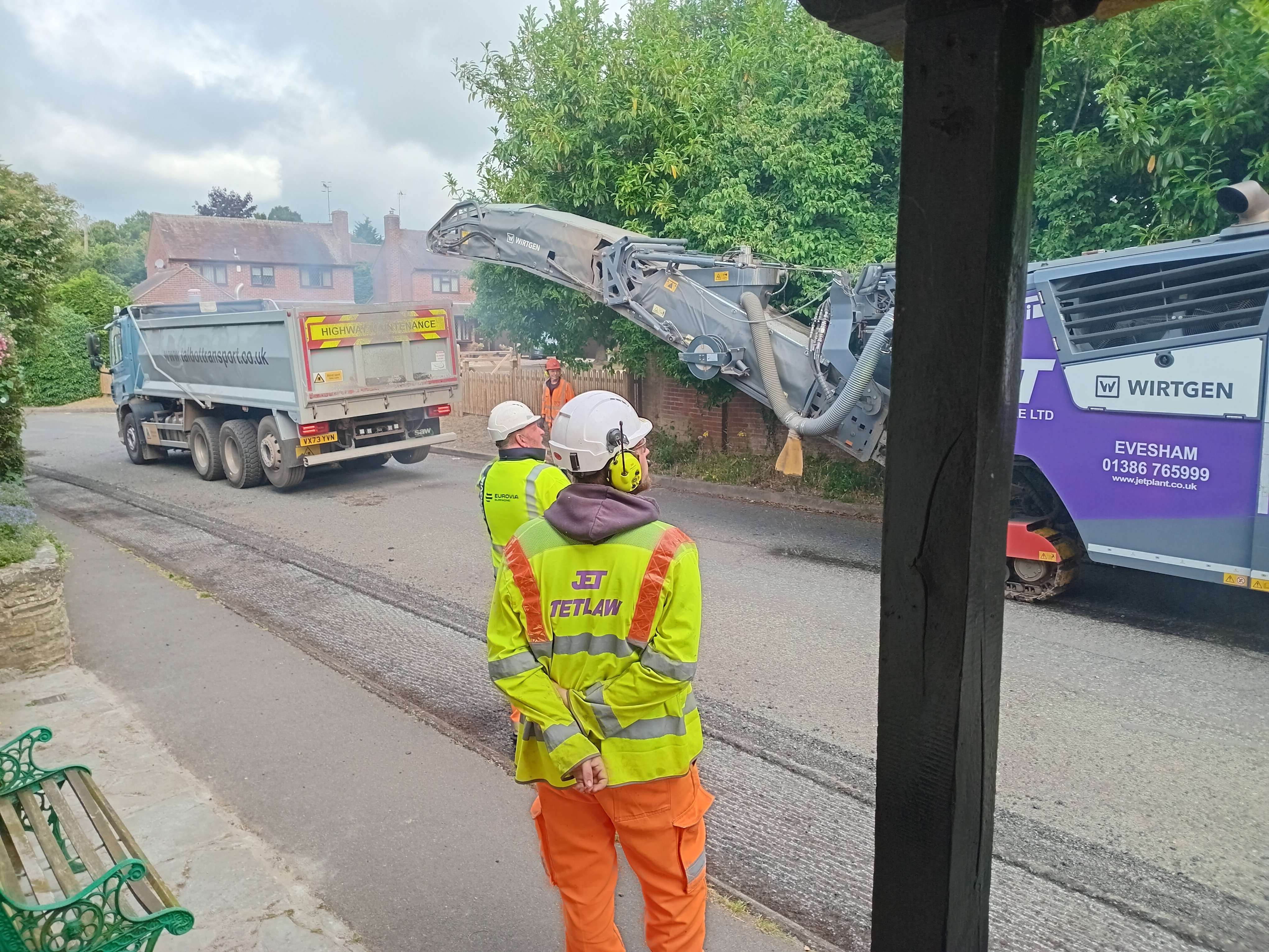

Villagers had no knowledge of it being resurfaced since at least 1975. Major changes took place between 1935/6 when the junction of Stratford Road, Village Street and Church Street was widened dramatically with the loss of the two old blacksmith cottages which stood on the corner; while the road surface outside Crooked Walls was raised considerably with a new pavement and kerbs, the slope up towards the pub was once much steeper. Were they resurfaced again between the 1930s and 1975, possibly so since it was main road and carried a large amount of traffic.
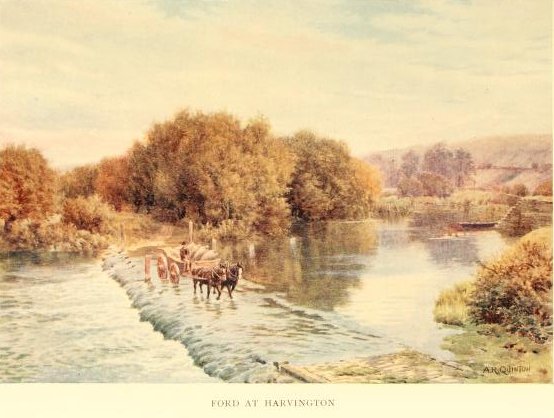
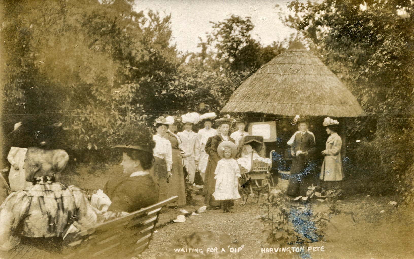
SEPTEMBER 2024 THE FERRYBOAT AND FORD:- The Ferryboat was a little boat that was moored on the River Avon just upstream from weir at the bottom of Anchor Lane. Folk still remember it in the early 1980s as a little iron boat attached to a chain that extended from one bank to the other. The steps on the Offenham side are still visible (2024). The sketches below depict the steps (possibly previous steps and boat) and boat in 1900 but it is not known how far back in time this little passenger ferry existed. The Ford was navigable back in the 1980s both for vehicles and, when the river was low, for folk. However in recent years access has been restricted by the local landowner. This was an ancient and important crossing for many hundreds of years.

 sketches by Charles Showell.
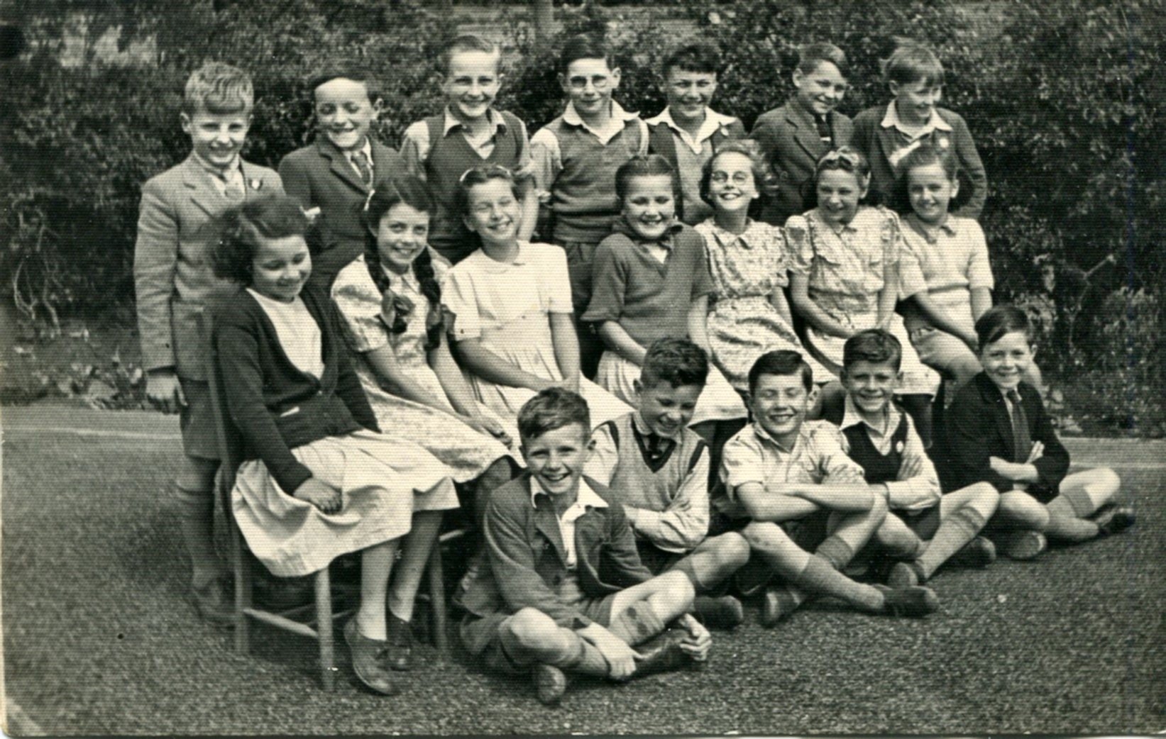
JULY 2024 HARVINGTON SINGERS:- The Harvington Singers have performed excellently for many years. This is a sample of one of their twice yearly performances.

June 2024 For the last couple of years a very successful festival has taken place in Harvington, which included a number of events. One of the main organisers were Chris and Ali Rushworth but there were many other contirbutors. It was thought while to preserve this leaflet for the future.


May 2024 In his youth Peter Hemming remembers that the large field below Manor Farm, through which the footpath leading from Shakespeare Lane and St Ja mes's across the modern bypasses down to the river, was once a cherry orchard.
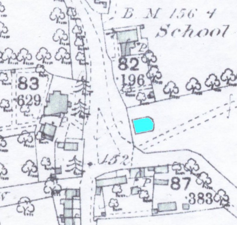
FEBRUARY 2024 There was once a village pond situated on or near the Village Green. This has now become almost a folk tale as all knowledge of its location has been lost; one theory is that it was under or near the Village Hall built in 1922. To give more weight to the tale there are the nearby Pool House and Pool Cottage, which have been so named from at least 1911. The area between the school and hall is subject to flooding during intensive downpours. Starting in 2023 and running into 2024 there was a major undertaking to improve the flood relief situation around the School. This involved the digging of a trench down Station Road. The workmen started at St James' Close with a trench running up the centre of Station Road towards the School. They dug their trench some three meters in depth up the centre of the road. As they approached and passed the Village Hall they were asked to keep an eye out for a anything unusual in the depth of the natural subsoil. It should be pointed out that they removed all material from their trench and replaced it with gravel. When they approached a point between Pool Cottage and the hall entrance, they inserted an inspection pit. At this juncture they noted that the natural fell away and they encountered silt up to a depth of two metres. Still keeping to the centre of the road the section continued at this depth for approximately 12 metres to a point roughly between the hall entrance and the gateway to Cedar Lodge and then resumed its normal depth - we had found the 'pool'!
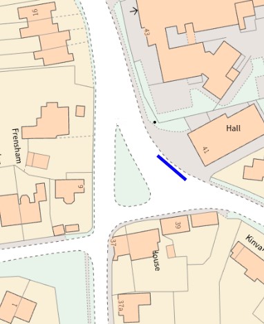
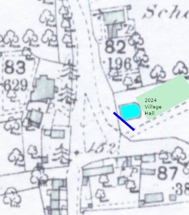
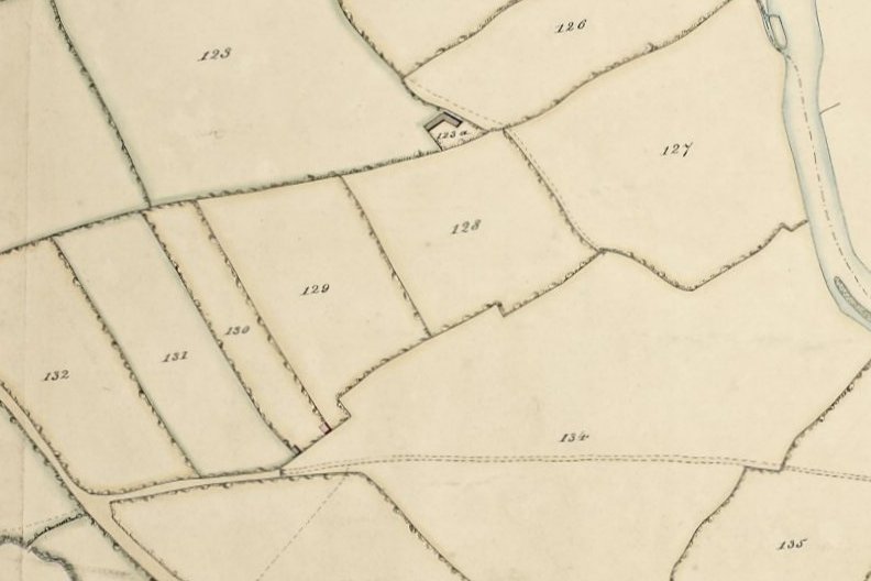
Extent of the exposed section and a superimposed impression on the 1888 OS map by Chris Haynes. We have to remind ourselves at this point that although we have located the pool we still cannot prove its dimensions. Here are four early maps/plans of the immediate area of the Green.
 1828-32 OS map & the 1838 tithe map.
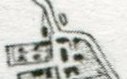
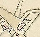
The above maps give us an idea of the, apparently changing, layout of the Green. On the first three there is little or no indication of a pool; the OS map of 1928-1932 displays the road running down Village Street, passing the entrance to the later Cedar Lodge and then encountering a right-angled junction with a road/track which passed close to Pool House/cottage then turning down the later Station Road; the tithe map of 1838 simply gives a large open space; the deed plan dated 1887 depicts a curious circle nearby; the highly detailed OS map dated 1888 gives us a rectangular pool under of near to the Village Hall, which appears a bit too far to the east from the evidence in the trench.
SEPTEMBER 2022 In August 2022 I received an email from Steve George regarding an old telephone that he had acquired with the number 'Harvington 365'. Unlikely but does anyone recall this number and to whom it belonged?
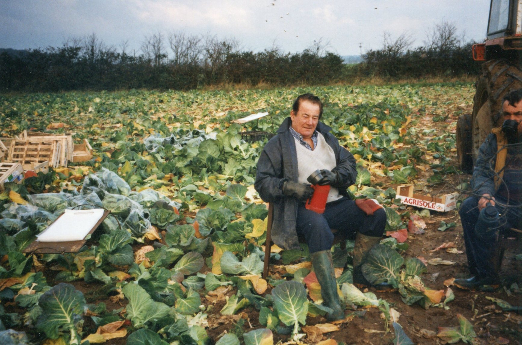
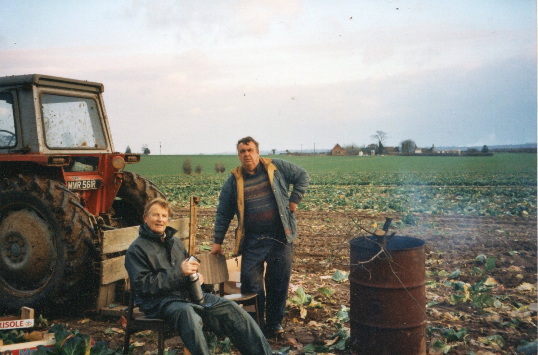
JULY 2022 John Shailer is believed to be the last 'market gardener' of Harvington. The term Market gardener appears constantly in the various censuses of Harvington to describe someone who grew and sold locally grown produced. Market gardening grew out of the traditional open-field system of growing food for consumption and sale. The practise had evolved over many centuries from the very beginnings of Harvington. John Shailer took the following photographs probably in the early 2000s of villagers harvesting cabbages on two plots, one on Barrow Field and the other on the low lying fields behind Longlands.
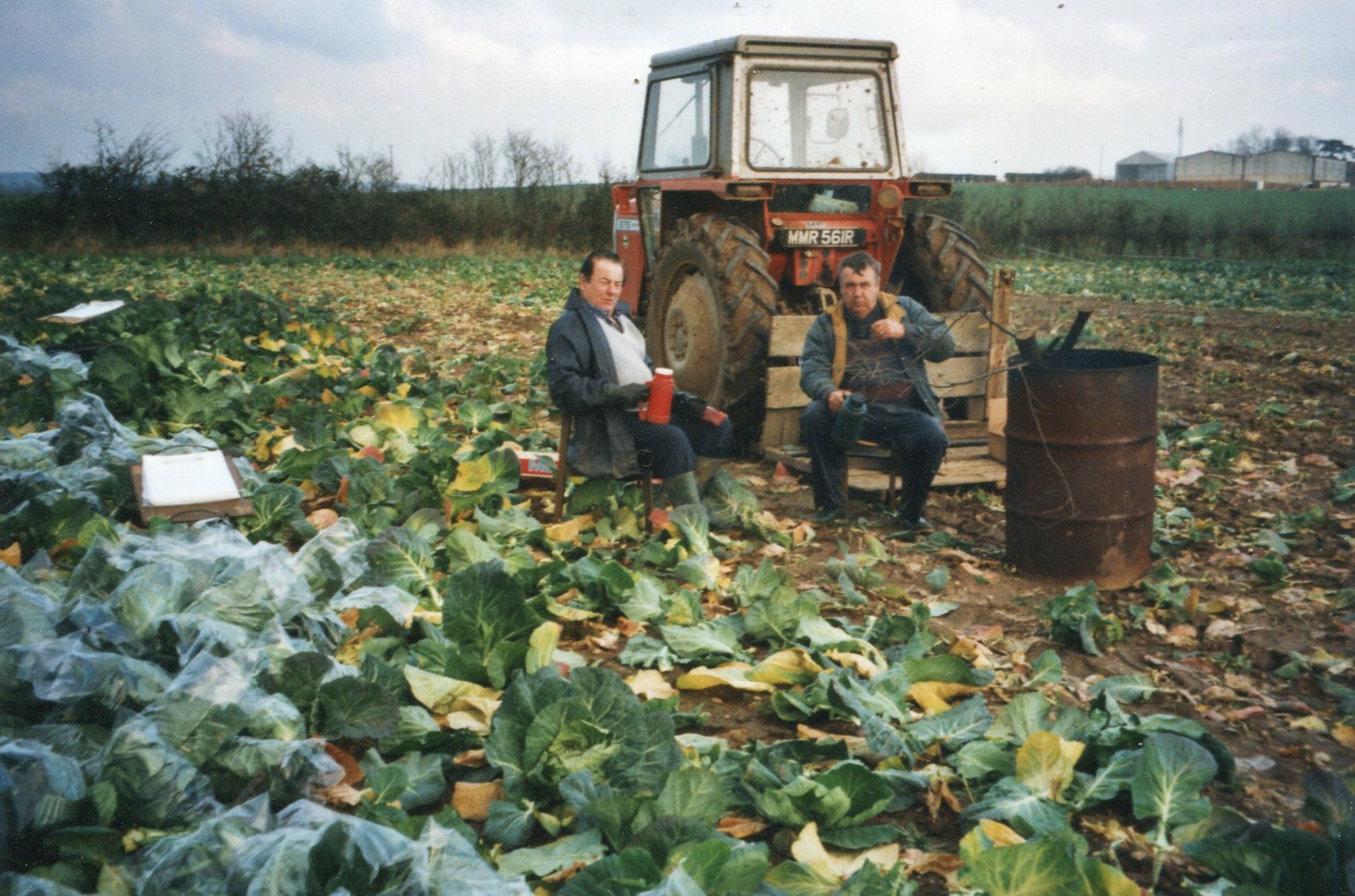 Taken on Barrow Field looking towards Harvington Lodge with Gerry Millard & ?.
MAY 2022 The Man Who Planted Trees is a short story written by Jean Giono and published in 1953. A delightful animated film was subsequently produced in 1987. The story is centred on Elzéard Bouffier a French shepherd who lived in the south of France. Over many years he collected and planted tree seeds in an otherwise barren and windswept landscape and was instrumental in bringing back life and vitality to the area. We had our own man in the guise of Hugh Nunn a plantsman who lived at Orchard Place in Village Street. He and his wife started the now well-known Harvington Hellebores. In 1990 the National Tree Council Warden Scheme was established. Hugh Nunn became the Warden of Harvington Parish in 1990, a position he held until 2015. During that time he planted around 380 trees on verges in and around the village. These specimens are now a maturing legacy enhancing an otherwise rather barren landscape. These supplemented a few trees planted by the Highways Department in the 1970/80s. Hugh Nunn was also deeply involved in the running of the Baptist Chapel. He and his wife retired and moved to the Stamford area in Lincolnshire to be nearer their family. The man who planted daffodils: About eight years ago (2014) I decided to follow in Hugh Nunn's footsteps and plant daffodils! Firstly around each tree and latterly in more massed arrangements on the Leys, Alcester, Evesham and Salford roads.
DECEMBER 2021 He is one of the subscribers to William Tindal's History & Antiquities of the Abbey of Evesham in 1796.
DECEMBER 2020
Old photograph of potato gatherers placed on Facebook Harvington memories by Terry Prudden. 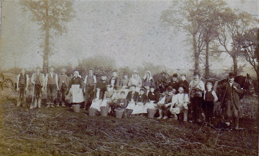 Second sitting man from right is Charles Ludlow.
July 2020 The sad loss of a little girl has come to light. The Burial Registers record the death of Mary Constantine Spencer, who was buried on the 23rd May 1832, aged 8 years. Clive Allen, the Virger, came across the little girl while he was correlating the Registers and Burial Plan and discovered that there was no indication as to where she was buried. The National Registry Index records the death of Mary Constantine Spencer, Jun (quarter) 1932, aged 8 but the only likely birth found was in 1924 in Ware, Hertfordshire. The Burial Book records that she was livng at 'Hilltop Farm', it is surmised that this is Hill Farm, the now ruined house within sight of Harvington Lodge. Investigations are ongoing but there was a family called Spencer running the Harvington Stores in Village Street in 1949 called Amy M and Ethel A Spencer. They were not in the village in 1939 so there is probably no connection. Her burial certificate was purchased and a copy placed on the Burial Ground page under Infant Burials. Does anyone know of this little girl?
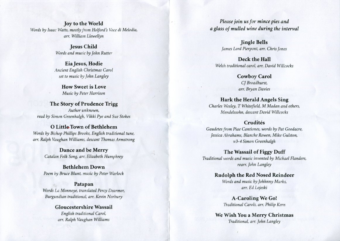
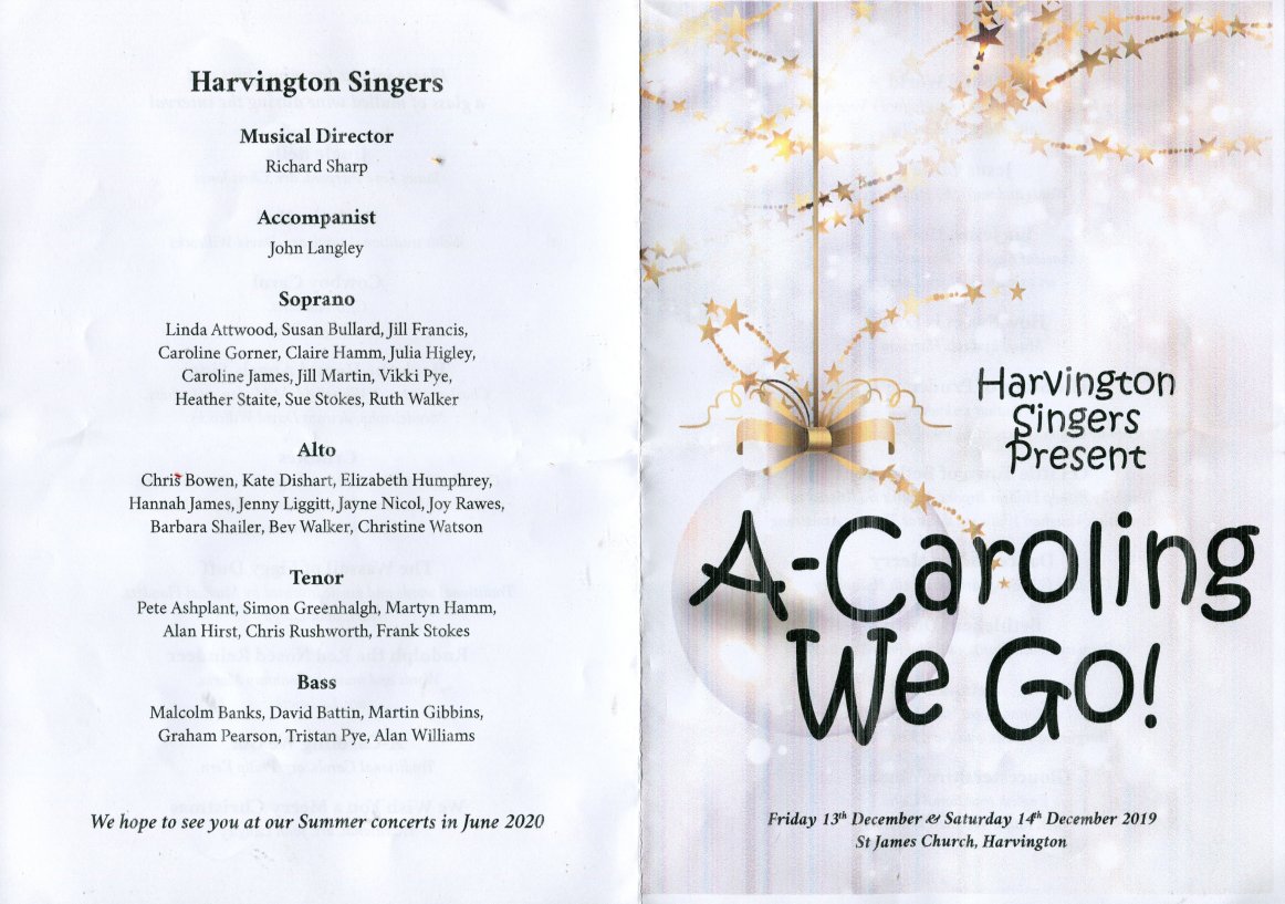
Jan 2020 For many years the Harvington Singers have performed in St James the Great. They arrange both a summer and winter concert spread over a Friday evening with a repeat performance on Saturday afternoon. The present and third musical director is Richard Sharp with a current choir of around forty. The first conductor was Martin followed Peter Harrison from Pebworth. The group have been performing for approximately 25 years. Here is an example of their programme.
June 2019 Harvington
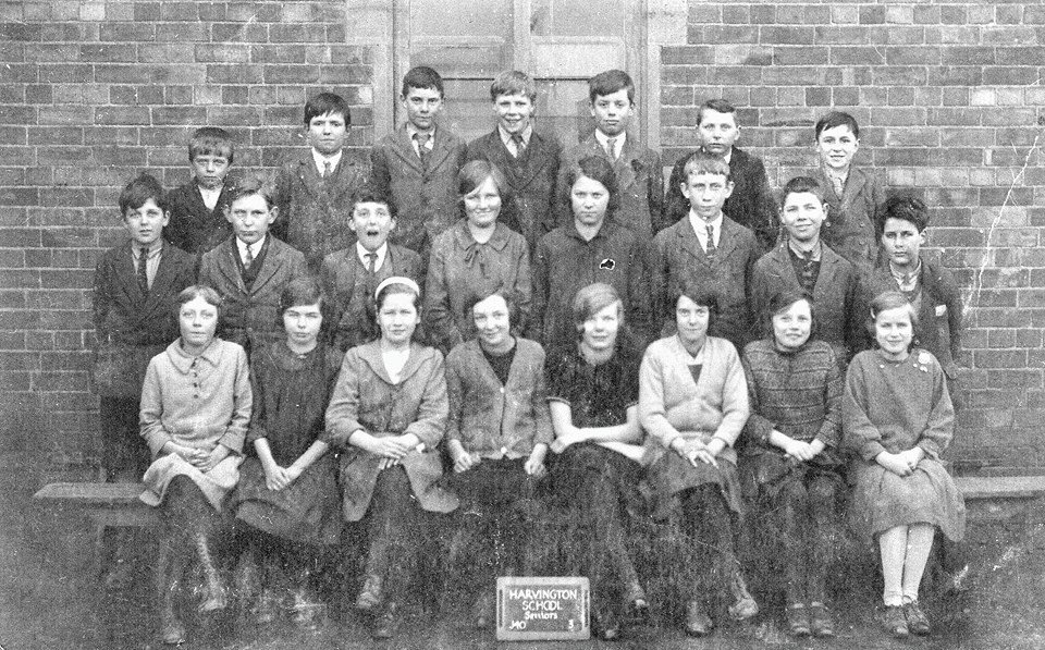
June 2019 Harvington, containing 52 houses and 262 inhabitants.
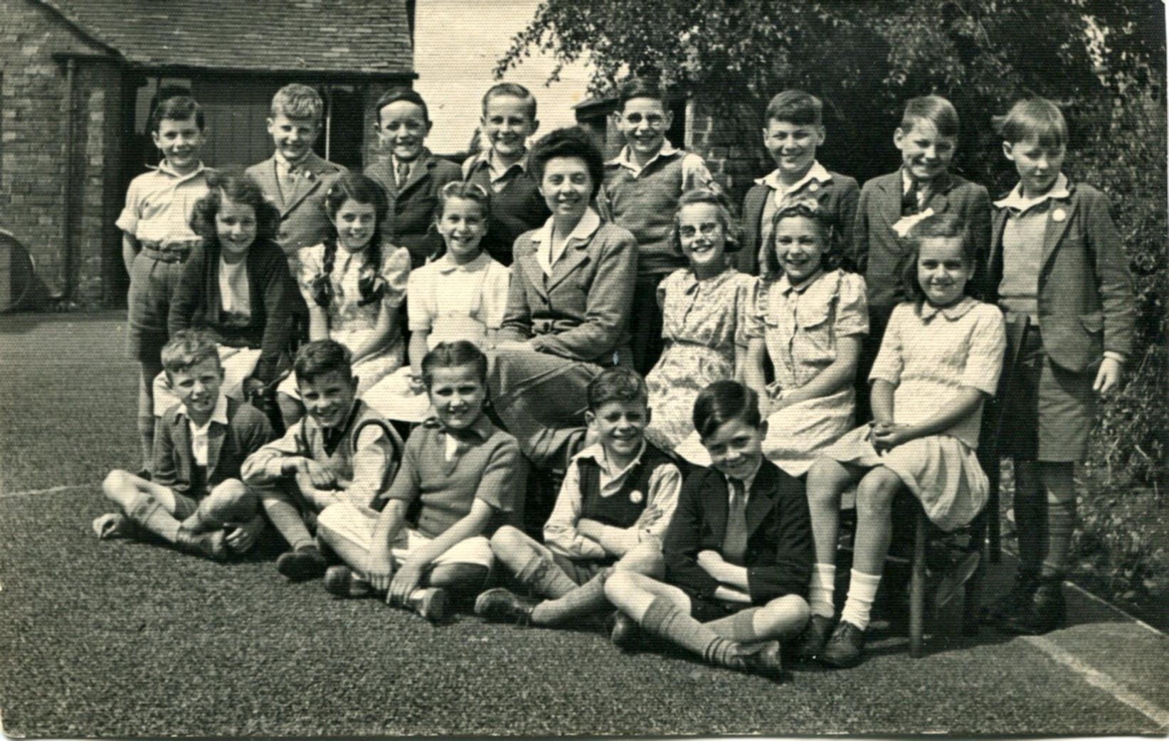
June 2019 In WW2 a bomb landed in an onion field behind the school. No one was hurt but a number of windows in the school were shattered.
March 2018
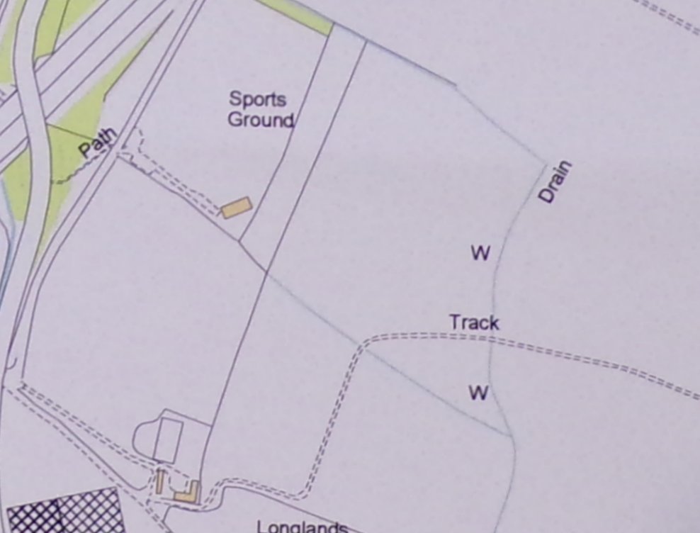
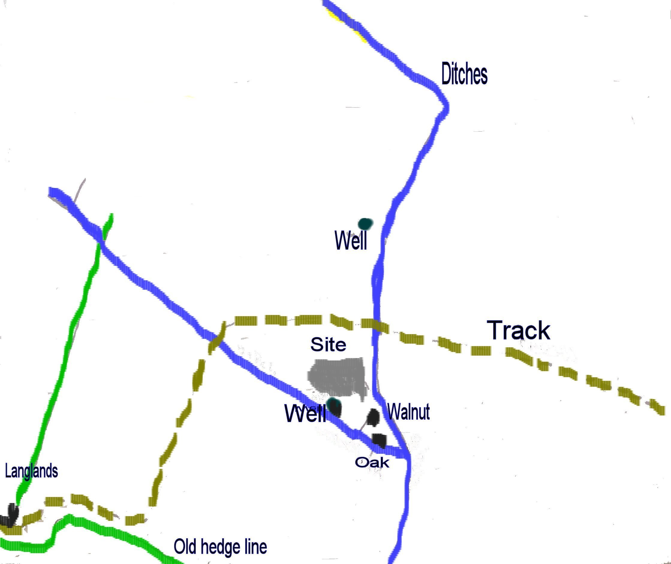
The two maps above shew the area in 1838 and 2015. The ditches and field boundaries have changed somewhat but one can, if intermediate maps are studied, see that an L-shaped barn, or its predicessor, existed in 1838. The southern 'W' (for well) indicates the position of our site, below is a more detailed sketch. The land here is low lying and truncated by large drainage ditches. The piece of land on which the barn stood is in a corner of land with ditches on two sides and a track on the third. One of the ditches is seen to curve around the site which suggests that the site is older than the ditch. All that now remains are a few visible Blue Lias footings indicating where the barn once stood, a well and two mature trees, a walnut and an oak. John Shailer remembers the barn as old and delapitated. It had two double doors big enough to take a tractor, and was used as storage by the market gardners who worked the surrounding land. There were internal divisions and it sometimes doubled up as sleeping quarters for itinerant workers. Does anyone have a photograph of it.
January 2018
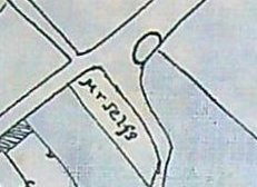
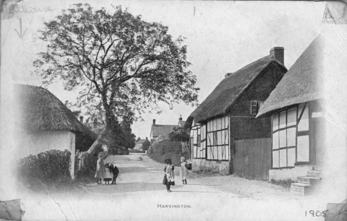 In the upper left hand corner of this photograph dated 1905 is the word Tollhouse with an arrow pointing to a small thatched building. The building is certainly positioned correctly and has the appearance of a tollhouse. Its position however is in the centre of the village which is strange. Does anyone know of another reference to this building?
August 2016 It has been noted that the word bank appears in a number of house names and lanes in the older part of Harvington. In all cases a sunken lane or rise of ground is present. Old Harvington was a village of slopes and sunken lanes and many were far more pronounced than they are today. The surface of the streets or roads, or lanes as they once were, have been raised, in the case of Church Street by as much as three feet in places.
The banks in Harvington have helped to create a style of house construction in that the older timber-framed buildings tend to be set upon Blue Lias stone platforms faced on the roadside by revetment walls. The layout is reminiscent of the house platforms to be seen in deserted medieval settlements.
October 2015
December 2015
December 2015
December 2015
December 2015
December 2015
December 2015
August 2017
December 2015
December 2015
December 2015
October 2015
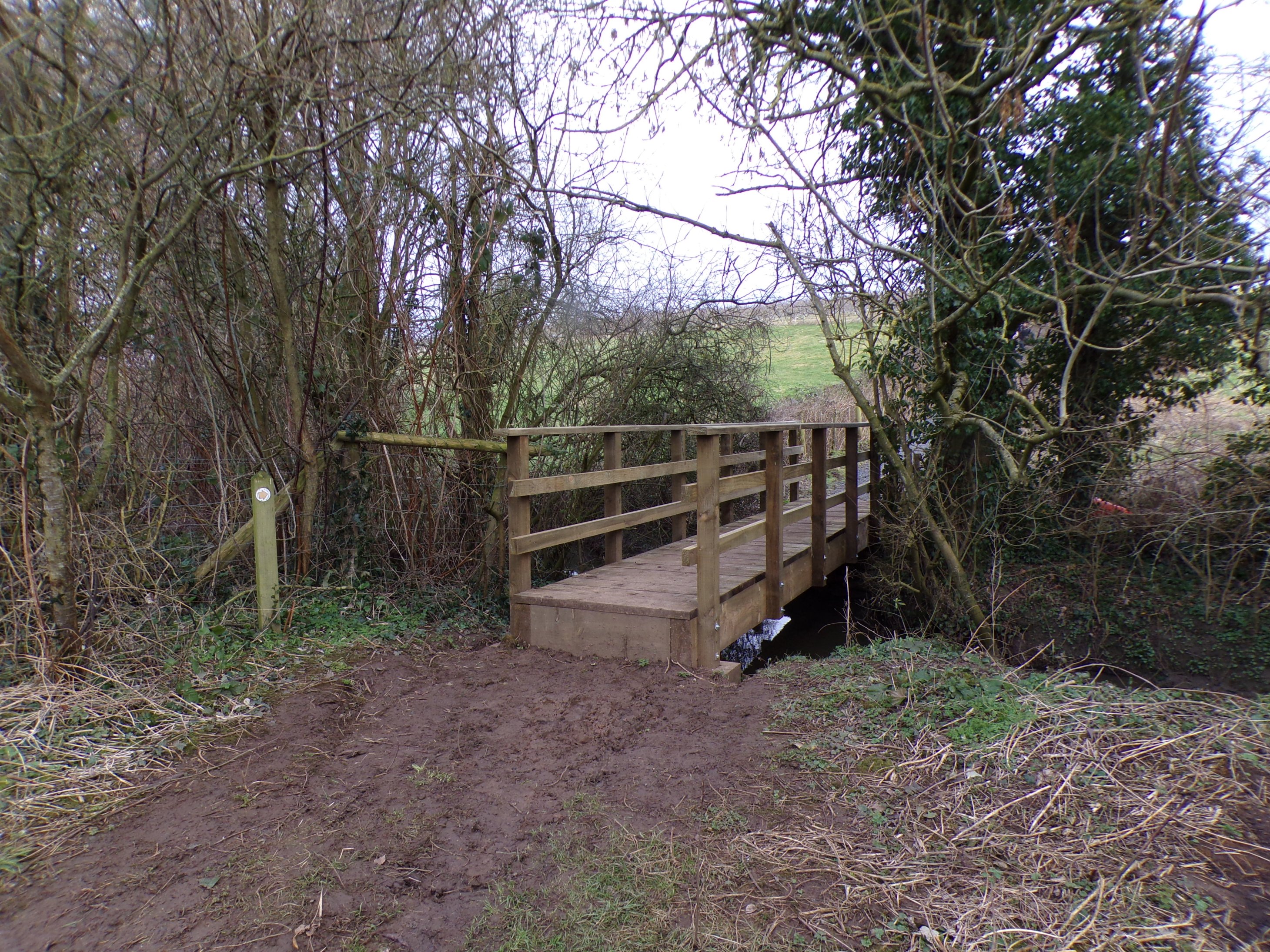 A new bridge, placed here in early 2018. MONKEY ISLAND: There is no monkey and no island, however from at least the 1940's the wooded area around the footbridge crossing Harvington Brook has been known by the village children as Monkey Island. The footpath which crosses the bridge dates from at least Victorian times and connects Harvington with neighbouring Norton. References are from the Davies children of Crooked Walls in the 1980's and Mike Harris who remembers the name as a child in the 1940's. The area was surrounded by orchards and it is possible that this copse of larger trees was treated by the village children as their own 'secret' island. Trevor Yeo suggests another possibility of a story he heard many years ago: "And apparently one of the theories as to why it's called Monkey Island is because some army officer brought monkeys back from the Boer War in South Africa in Victorian times". He also recalls an incident "Over 25 years ago there was an unfortunate incident at Monkey Island whereby a tree caught fire and I ended up putting it out by using an old paint can with some water from the stream. Because I was there that night I got blamed for setting fire to the unfortunate then willow tree!"
| ||||||||||||||||